 FAYETTEVILLE STREET: OBERSERVATIONS AND RECOLLECTIONS
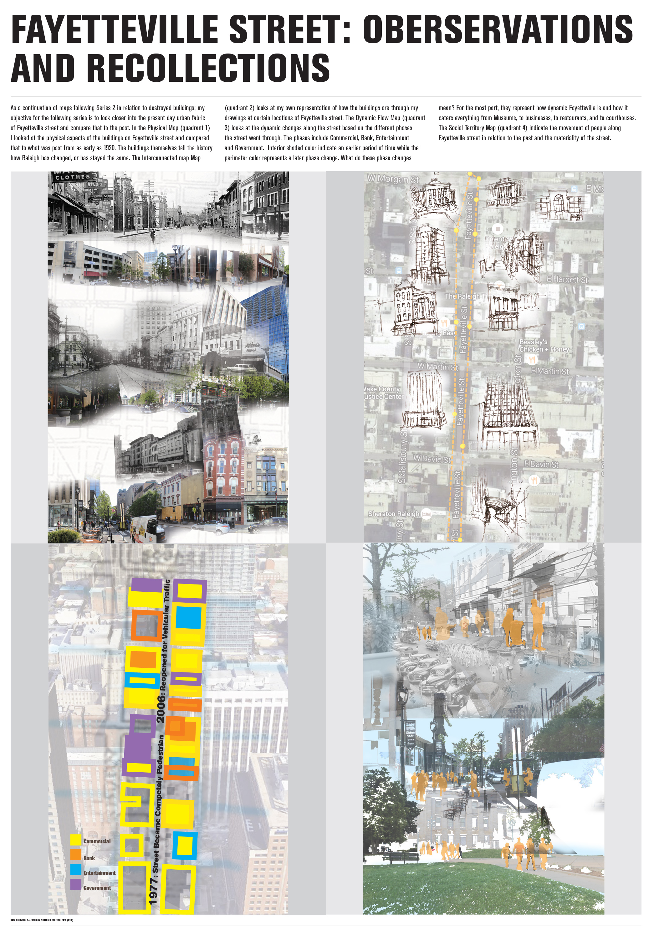
As a continuation of the maps related to destroyed buildings presented in Series 2, my objective for this series is to examine the present day urban fabric of Fayetteville Street and compare it to that of its past.
In the Physical Map (Quadrant 1), I looked at the physical aspects of the buildings on Fayetteville Street and compared them to features that date back as early as 1920. The buildings themselves tell the history of how Raleigh has changed, yet in some ways has stayed the same. The Interconnected Map (Quadrant 2) looks at my own representation of buildings through my drawings at certain locations of Fayetteville Street. The Dynamic Flow Map (Quadrant 3) looks at the dynamic changes along the street based on the different phases in the street’s history. The phases include commercial or retail, banking and financial institutions, entertainment facilities and government buildings. Interior shaded color indicates an earlier period of time while the perimeter color represents a later phase change.
What do these phase changes mean? Mostly, they represent the multitude of dynamic options Fayetteville Street offers; everything from Museums to businesses and restaurants to courthouses can be seen within walking distance of one another. The Social Territory Map (quadrant 4) indicates the movement of people along Fayetteville Street in relation to the past and the materiality of the street.
FAYETTEVILLE STREET THROUGH OBSERVATION AND TIME
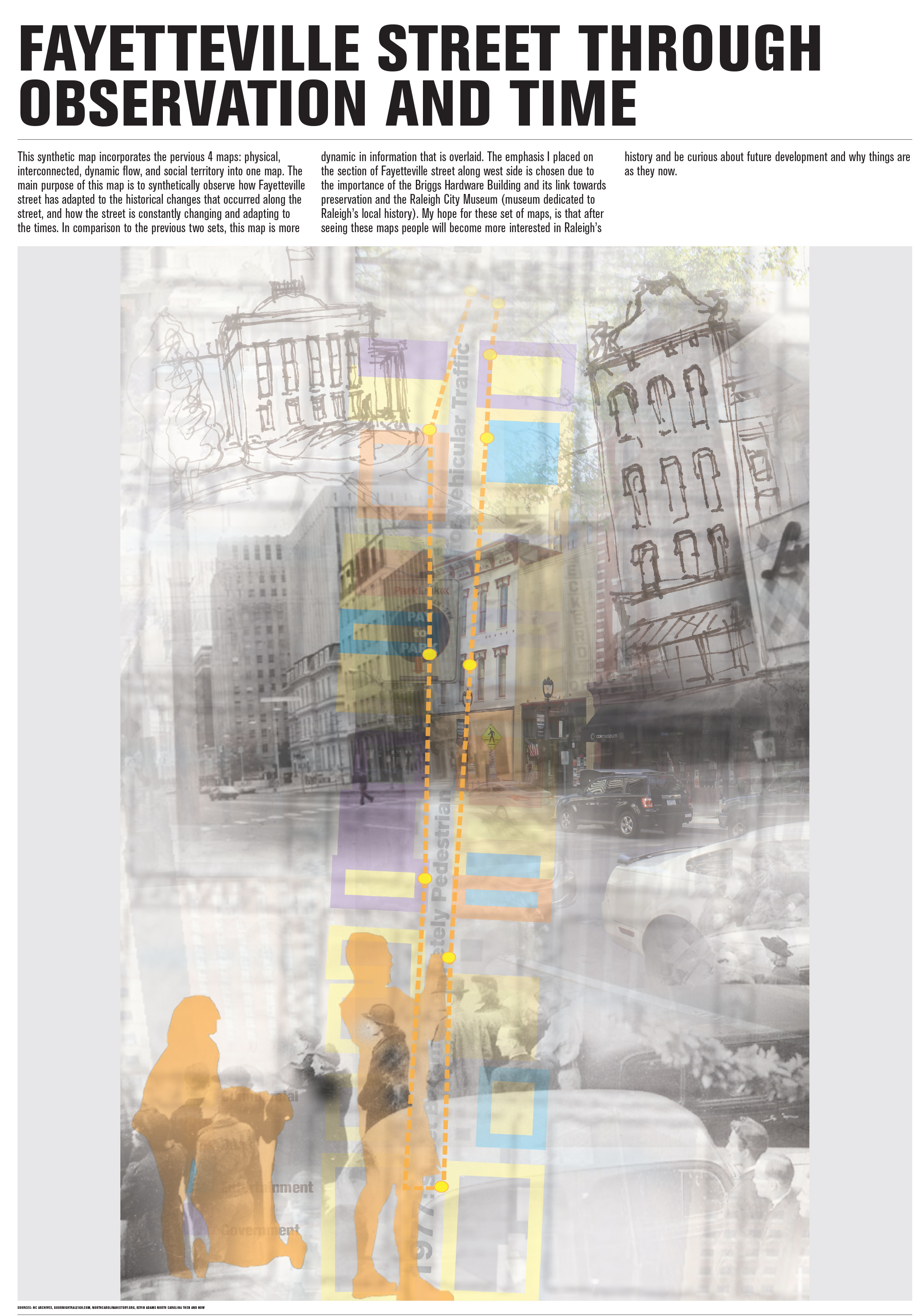
This synthetic map incorporates the quad series maps, physical, interconnected, dynamic flow, and social territory into one map. The main purpose of this map is to synthetically observe how Fayetteville Street has adapted to the historical changes that occurred along the street, and how the street is constantly changing and adapting to the times. In comparison to the previous map series (1 & 2) this map is more dynamic in that information is overlaid. The section of focus is placed along West side of Fayetteville Street and was is chosen due to the importance of the Briggs Hardware Building and its link to preservation and the Raleigh City Museum (a museum dedicated to Raleigh’s local history).
My hope for this my series of maps is initiate more interest in Raleigh’s history as well as spark curiosity about future development.