 FROZEN IN TIME: MEMORIALIZING THE CIVIL WAR & RALEIGH: A MONUMENTAL CITY CENTER
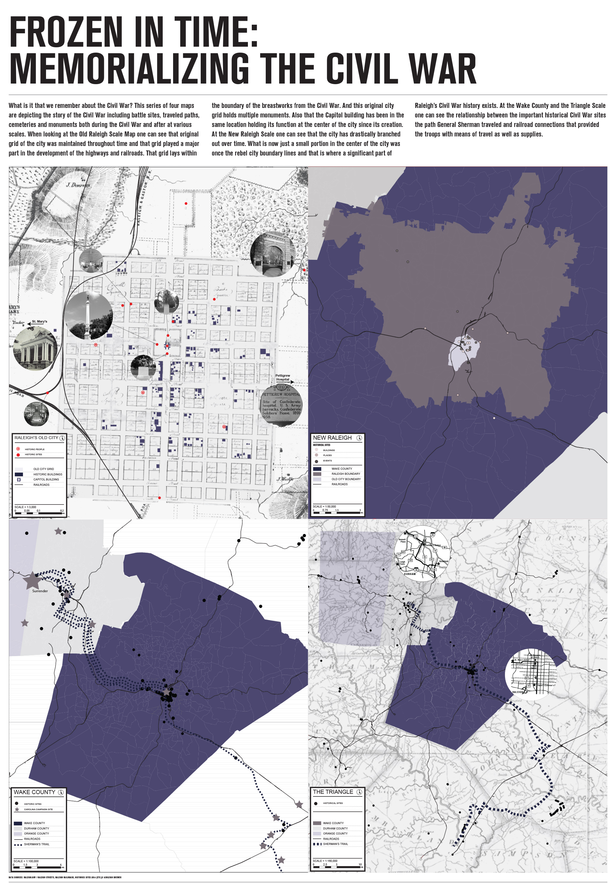
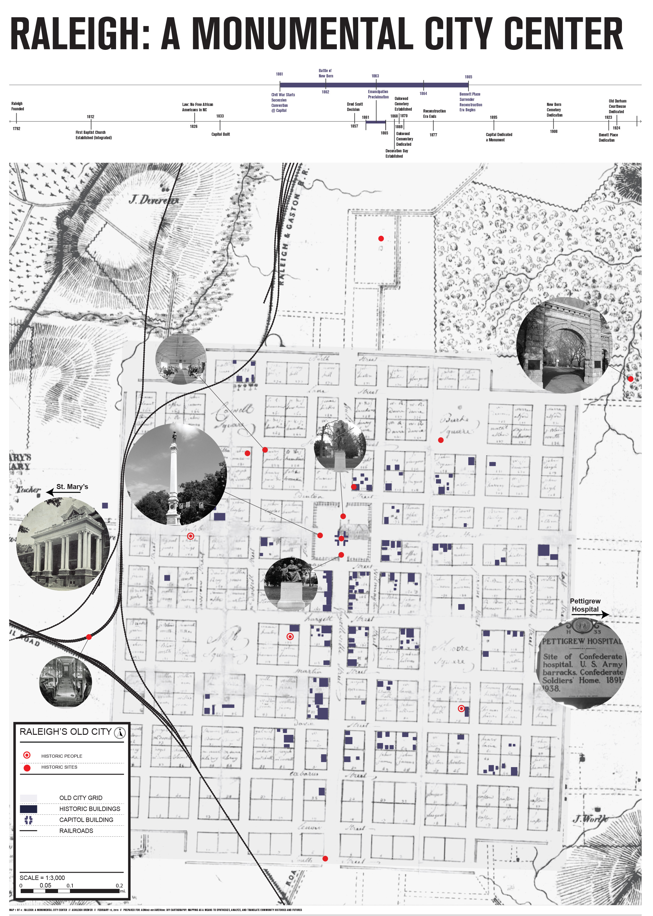
What is it that we remember about the Civil War? This series of four maps depicts the story of the Civil War at various scales and includes battle sites, traveled paths, cemeteries and monuments present both during and after war. When looking at the Old Raleigh scale map, one can see that the original grid of the city was maintained throughout time and that grid played a major part in the development of the highways and railroads. The grid lies within the boundaries of the breastworks from the Civil War and holds multiple monuments. The map series also shows the Capitol building in the same location holding its function at the center of the city since its creation. At the New Raleigh Scale one can see that the city has drastically branched out over time. What is now just a small portion in the center of the city was once the rebel city boundary line; a site where a significant part of Raleigh’s Civil War history exists. At the Wake County and the Triangle Scales one can see the relationship between the important historical Civil War sites, the path General Sherman traveled, and railroad connections that provided the troops with means of travel as well as supplies.