Abstract
Imagine walking down a recently redeveloped street and having an entrepreneur give you an account of how he chose a particular building for his new, locally-based business. Or if the planter of bright flowers by the court house becomes tinged with sorrow when you hear about how a lawyer sat beside it for ten minutes, wiping away tears after being dumped via text on a Friday afternoon? What if the walls, street corners, trees, and alleyways of the city could talk, block by block? This crowd-sourced, interactive cartographic installation will give seasoned locals and newcomers alike a way to experience the frisson of voyeurism and to uncover alternative histories of our city through intimate and authentic stories told by contemporary residents and historical sources.
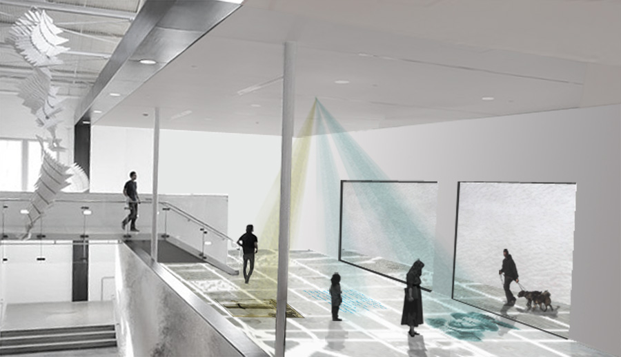
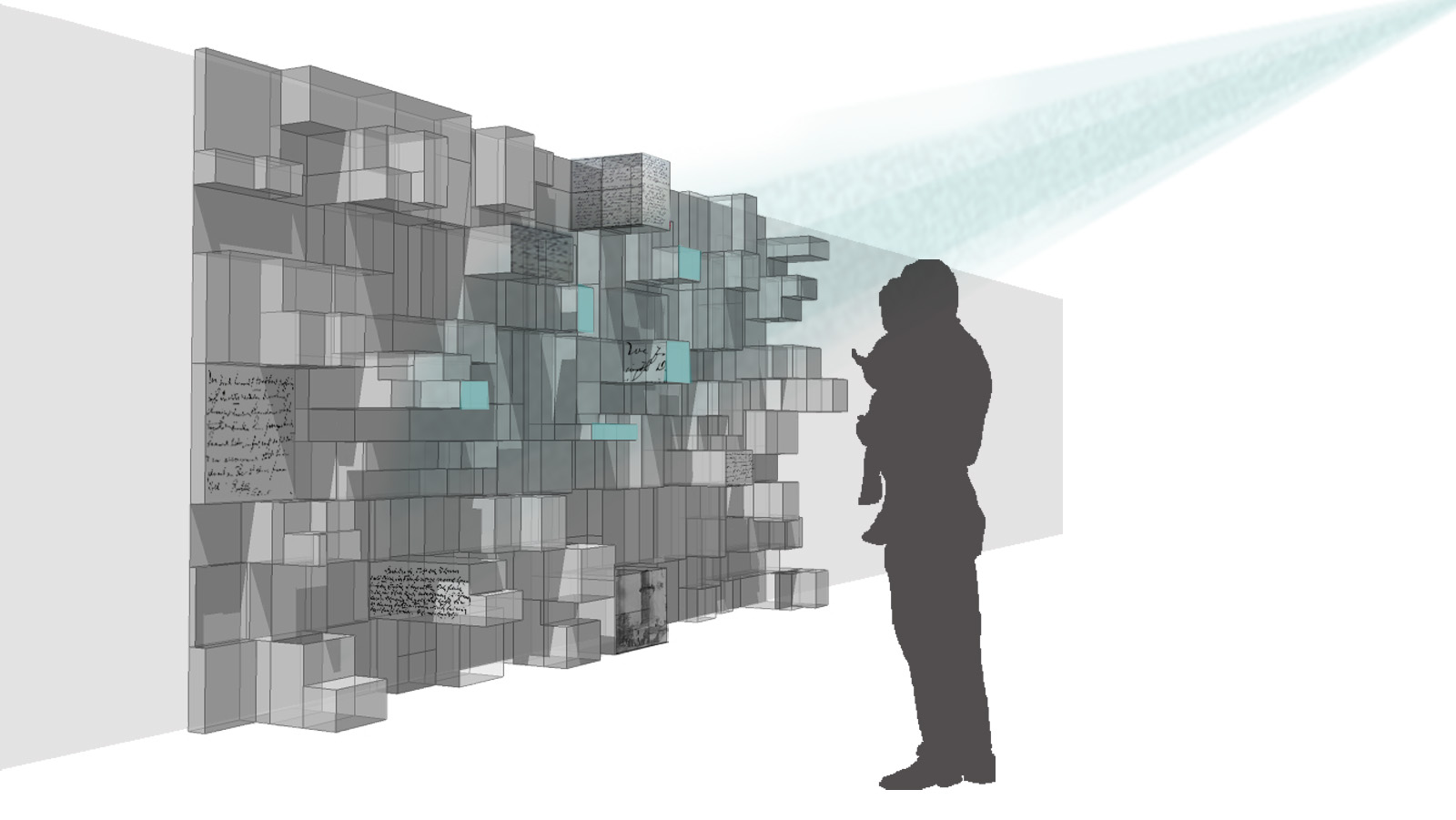
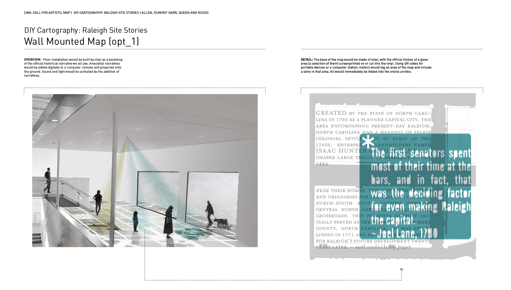
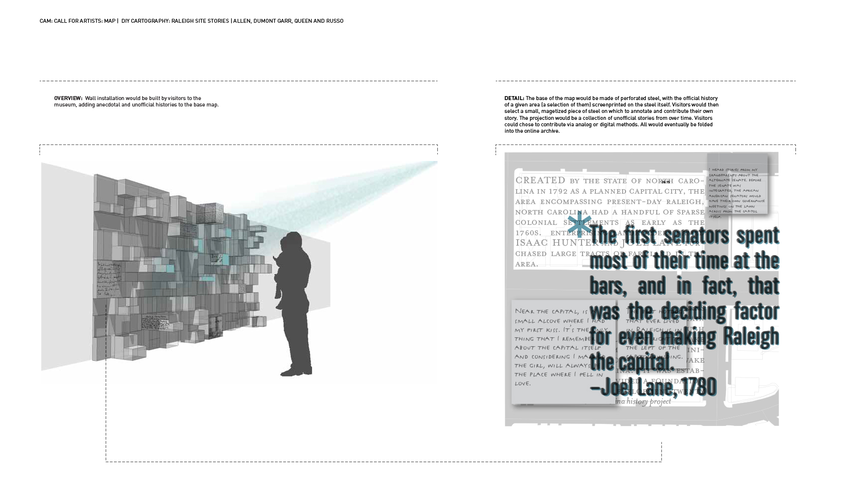
The resulting cartographic project is multi-level in nature. It will consist of a site-specific installation as rendered in the accompanying images and as a DIY urban walking tour. We propose the installation be placed on the floor of the Front Gallery or on the wall adjacent to the ramp. The installation will extend to the street edge of the building and either continue onto the sidewalk or onto the window to engage viewers at all hours of the day. The second component, the DIY walking tour map, would highlight landmarks and locations throughout the city as sites of historical events and personal histories archived by the project. The walking tour map will primarily live online where users can sort types of stories, plan their itinerary, print their map, and even submit new personal histories to the story sites archive. Throughout the city and within the installation, each story site will be accessed by scanning posted QR codes where users are directed to imagery and pertinent resources, including downloadable audio. A companion numbered list of stories connected to addresses on the map will accompany the QR codes for those who prefer not to use smart phones in order to participate.
The installation portion of this project was designed to be responsive and change over time, or by the order in which participants experience it. The cartographic content consisted of official and accepted historical events overlayed with projected personal and hidden accounts. Both the physical map and digital projections will be interactive and transform over the course of the exhibit through the aggregation of new digital and physical content. We hope to continue to collect stories during the exhibition by inviting CAM visitors to contribute through hand written stories, video and audio recordings, and by digitally submitted stories and images via the story sites website. Visitors will be given an option to ‘contest’ a story, whether contemporary or historical. These responses to existing stories will read/function as a ‘comment’ on a Tweet or status update. Raleigh Site Stories explores the constantly evolving nature of collective urban space and highlights the relative truth of history when multiple perspectives are simultaneously included.