 SHIFTING GOVERNMENT BOUNDARIES THROUGH TIME
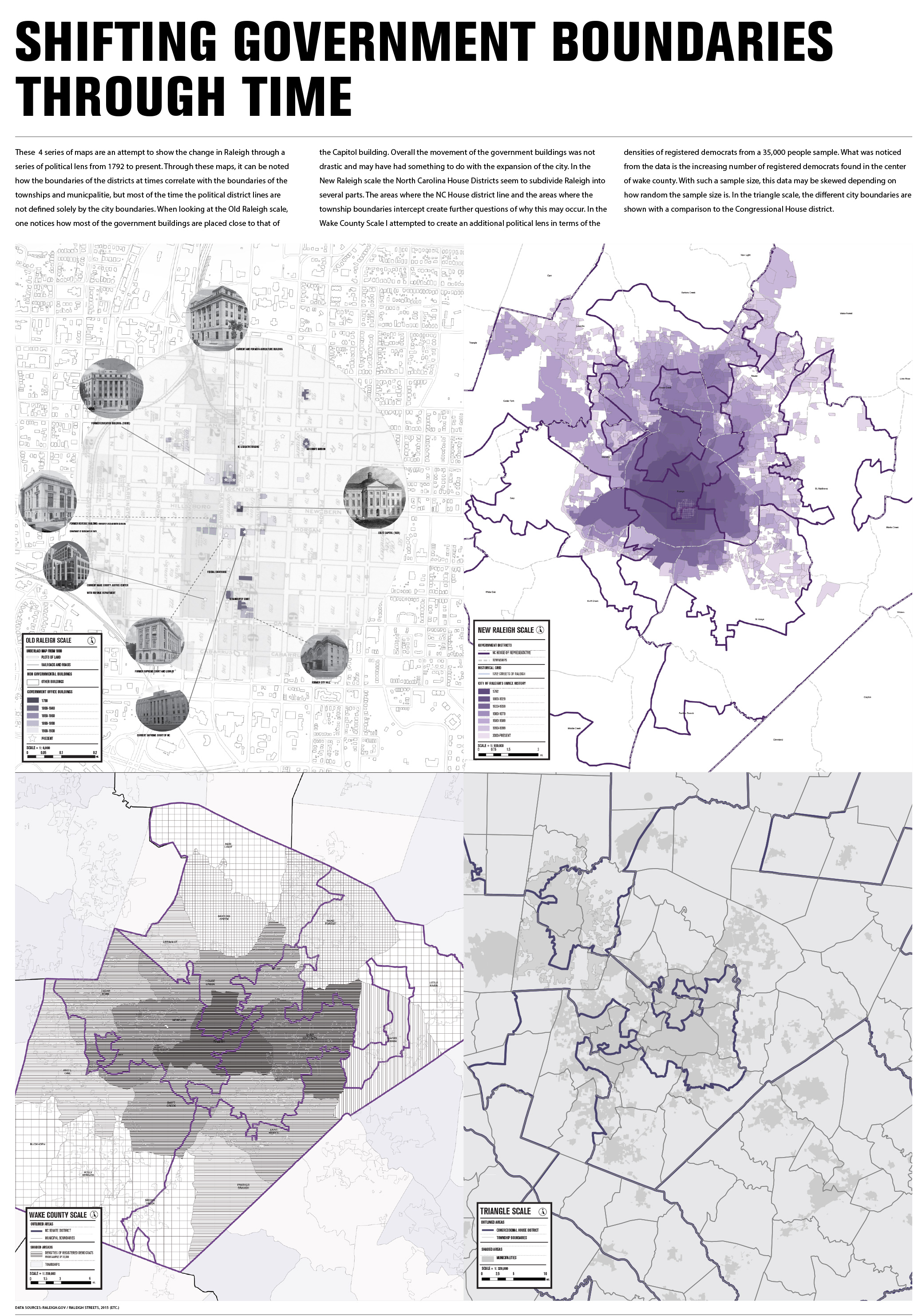
This map series shows the change in Raleigh through a series of political lenses from 1792 to present. Through these maps, it can be noted how the boundaries of the districts sometimes correlate with the boundaries of the townships and municpalities, but most of the time the political district lines are not defined solely by the city boundaries.
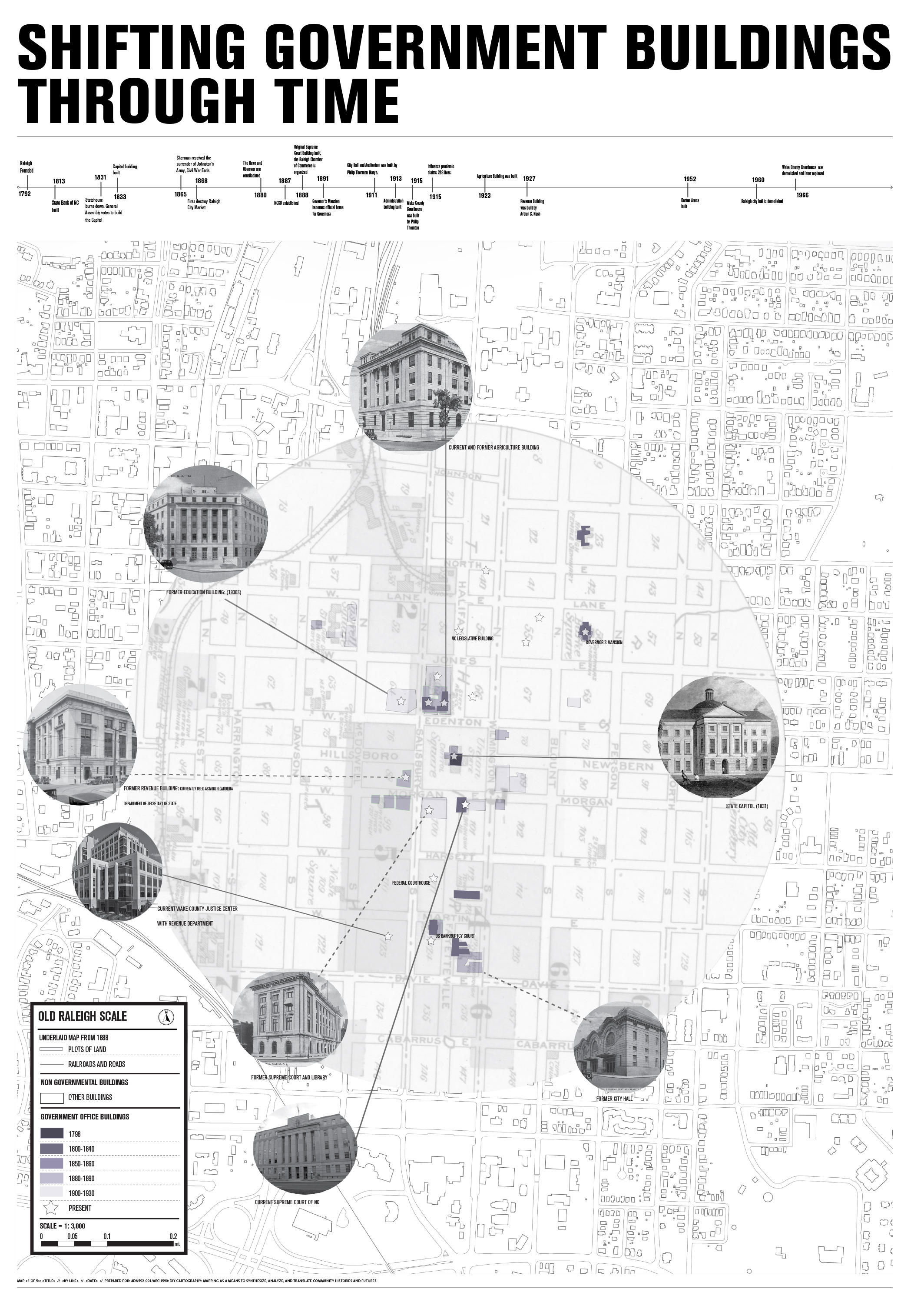
When looking at the Old Raleigh scale, one notices how most of the government buildings are placed close to that of the Capitol building. Overall, the movement of the government buildings was not drastic and may have had something to do with the expansion of the city. In the New Raleigh scale, the North Carolina House Districts seem to subdivide Raleigh into several parts. The areas where the NC House district line and the areas where the township boundaries intercept create further questions of why this may occur. In the Wake County scale, I attempted to create an additional political lens in terms of the densities of registered democrats from a 35,000 people sample.
What was noticed from the data is the increasing number of registered democrats found in the center of wake county. With such a sample size, this data may be skewed depending on how random the sample size is. In the triangle scale, the different city boundaries are shown with a comparison to the Congressional House district.